Manage User Coordinate Systems Tool

|
Manage User Coordinate Systems Tool |
|
|
Manage User Coordinate Systems Tool is used to create/edit/delete User Coordinate System Objects.
Find the Manage User Coordinate Systems Tool icon
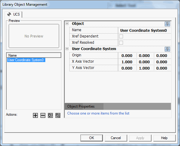
To select an object, click on one of the object names from the list displayed on the left hand side of the manage dialog.
To view the properties of a UCS, select a user coordinate system from the left panel. The "Preview" section will show the selected user coordinate system as it will appear in the drawing. All properties for selected user coordinate system are displayed on the right hand side of the manage dialog.
To add a new UCS object to the drawing, click on the add button (
To delete a UCS from the drawing, select a user coordinate system from the left panel. Click on the delete button (
To add/import UCS from current drawing, left click on the add current button (
To set the active UCS the in current drawing, select a user coordinate system from the left panel. Click on the set active button ( Also See: 


|